Nonprofit organizations Global Fishing Watch (GFW) and SkyTruth have reported that vessels on the world’s oceans may be using constantly improving technology to falsify and scramble their automatic identification system (AIS) coordinates, potentially carrying out illegal, unreported, and unregulated (IUU) fishing through the use of such technology.
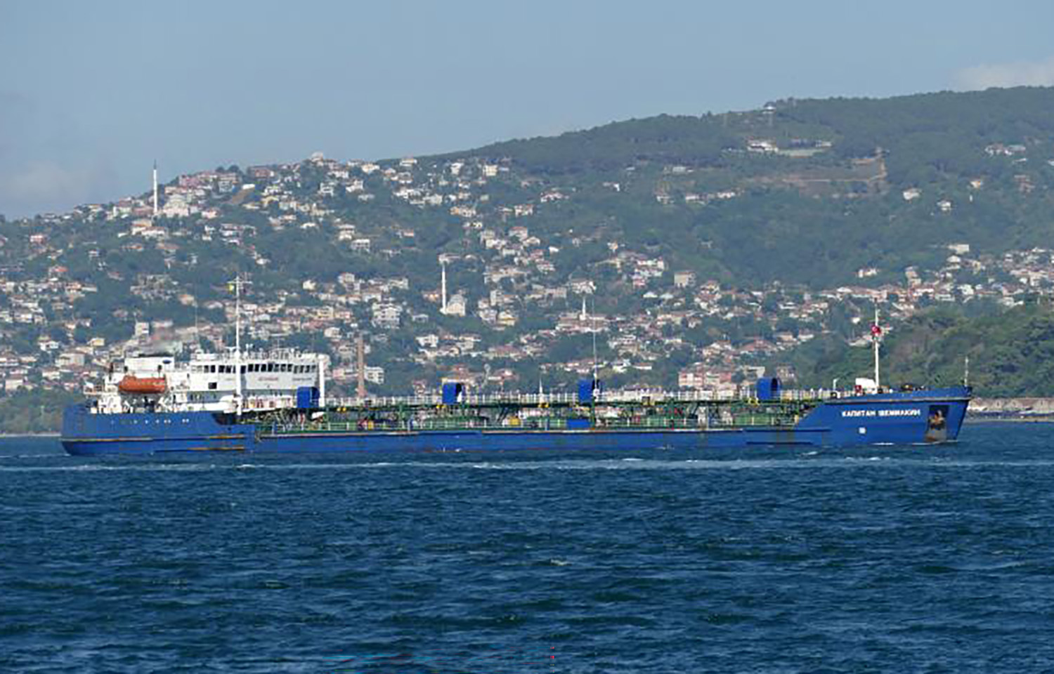
One of the first instances that alerted the organizations to this fact was a Russian-flagged tanker vessel that was found to be broadcasting false AIS coordinates on at least two separate occasions.
According to the organizations, the tanker, Kapitan Schemilkin, transmitted false positions over two distinct periods since the beginning of 2022. Satellite radar imagery failed to detect the vessel at the times and locations deceptively indicated by its AIS broadcasts.
“Ship detection with satellite imagery is not new. However, only recently, satellite imagery has been made freely available at global scale, and with the current advances in machine learning and cloud computing, we were able to perform this type of analysis at global scale for the first time,” GFW Research and Innovation Team Senior Machine Learning Engineer Fernando Paolo said.
The incident is a prominent example of a worrying trend, according to GFW. A recent GFW study revealed 72 percent to 76 percent of global industrial fishing vessels and 21 percent to 30 percent of transport and energy vessels remain untracked publicly. International law requires larger ships to use AIS to avoid collisions, and AIS information typically contains a vessel’s name, location, speed, and course.
Efforts to systematically detect false AIS broadcasts on a global scale resulted in the discovery of Kapitan Schemilkin’s false coordinates, with SkyTruth Project Manager and Analyst Bjorn Bergman spotting the Russian-flagged tanker circumventing AIS tracking by broadcasting fake coordinates. According to Bergman, not only did the vessel’s coordinates lack normal variations in course and speed, but the antennas receiving the purported locations also were well beyond reception range.
In some cases, false tracks are generated by a program and broadcast by a vessel’s AIS transmitter, Bergman said. Simple offsets in latitude and longitude are the most common false position patterns observed in fishing vessels and alert data analysts like Bergman to the possible fact that AIS transmitters, like the ones on Kapitan Schemilkin, are modified to offset locations.
“We’ve developed effective methods for detecting false AIS broadcasts, so as long as we are able to implement these methods systematically across our global data, monitoring for illegal, unreported, and unregulated (IUU) fishing shouldn’t be compromised. In fact, vessels falsifying their AIS will only attract attention to their activities,” Bergman said.
While it remains unclear what the tanker was attempting to do by falsifying its coordinates, it marked the first time a Russian-flagged vessel had been found acting in such a way. Fears have been stoked across the world that Russian vessels are spying on global ports, with such countries as the Netherlands banning Russian vessels from entering its ports due to these fears.
Kapitan Schemilkin was caught broadcasting false information, but there are other methods used by vessels to hide their activities, whether for malicious purposes or not. More simply, vessels turn off their AIS or their broadcasts are not captured by public monitoring systems. These unmapped vessels are often called dark vessels. Legitimate reasons vessels turn off AIS include a lack of local legislation requirements based on vessel sizes and types, to avoid detection by pirates in dangerous areas, a lack of signal due to congestion, and the usage of low-quality AIS devices or broadcast signals.
GFW has developed an AI model that can identify which of these vessels are likely fishing vessels and which ones are likely non-fishing vessels. This identification is based on size and physical and environmental conditions of the surrounding area where a vessel is operating.
Although AIS can be briefly silenced for legitimate reasons, this behavior often indicates a concealment of illegal activities, such as illegal fishing and forced labor, according to GFW. For example, Panamanian-flagged vessel recently turned off its AIS coordinates on the west side of the Galapagos Marine Reserve, only to reappear on the east side.
“Having its AIS turned off, especially when outside of the marine reserve boundaries, is not a sign of illegal activity. It simply means we are unable to publicly track the vessel’s activity," Paolo said. "It would be ideal, however, if AIS broadcasts were enforced everywhere for most vessel classes so we could publicly monitor all activity around and inside marine reserves."
For example, an Australian-flagged commercial fishing vessel turned off its AIS near the Heard Island and McDonald Islands Marine Reserve on 10 occasions in one year, according to GFW. Several Spanish-flagged commercial fishing vessels have also appeared to turn off AIS over a seven-month time period while operating in the national waters of five African countries and on the high seas.
To mitigate the issue, GFW aims to establish more partnerships with governments, particularly with ocean-bordering, resource-limited countries, to leverage datasets and technology to unlock a new wave of transparency in ocean governance and fisheries management.
“Transparency is crucial if we are to dramatically improve ocean governance and work toward a sustainable and blue future. Indeed, open data and increased transparency offer a scalable and equitable approach to transforming the way our ocean is monitored and managed,” Paolo said.


